Hiking Around Las Vegas, Gold Butte National Monument
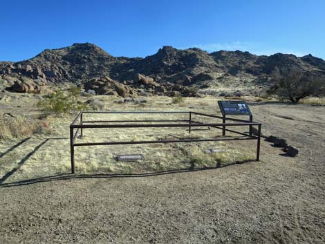
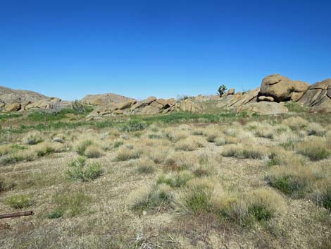
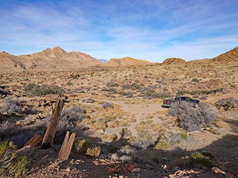
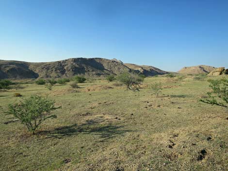
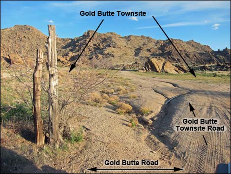 Gold Butte Townsite Road near Gold Butte Road (view S) |
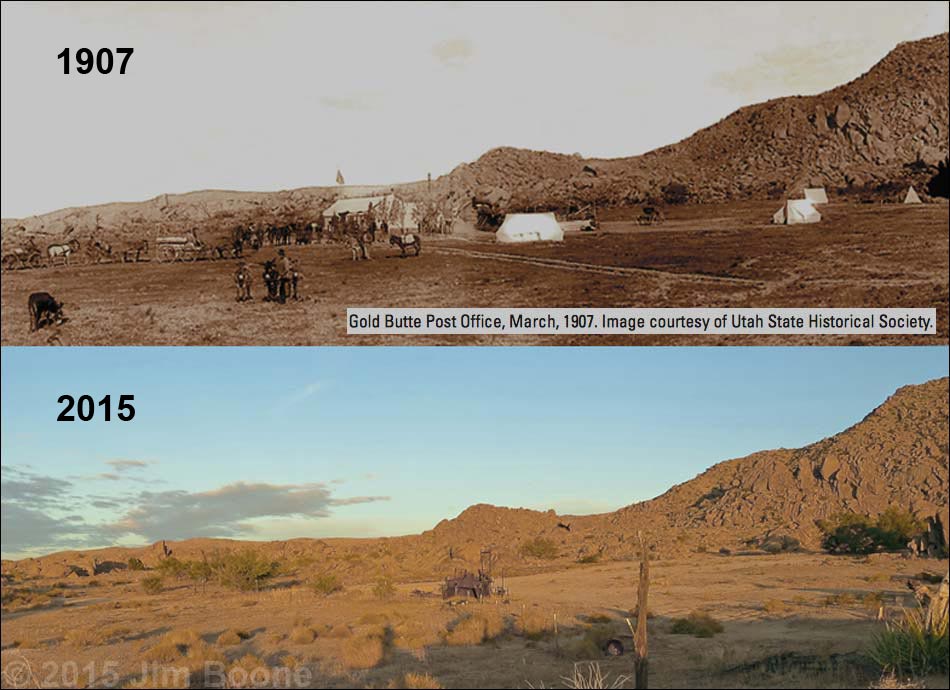
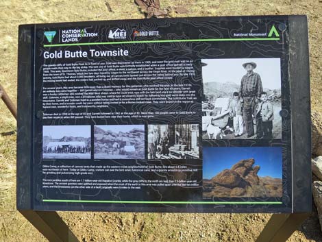
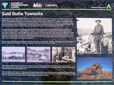
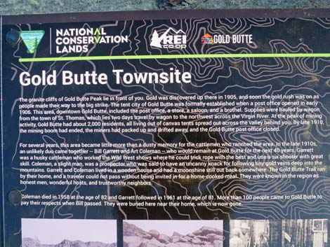
Overview The Gold Butte Townsite is an interesting place to visit and commune with the mining and ranching history of this wild and rugged region. in 1873, commercial grade muscovite (mica) was discovered at the Nevada Mica Mine on Rattlesnake Peak, a few miles south of the townsite. Then in 1905, gold was discovered on Gold Butte Peak, and when the news got out, miners poured into the area. The town of Gold Butte was formerly established in early 1906 with the opening of a post office. By 1908, the town had hotel, livery stable, saloon, mercantile, brothel, and some 2,000 residents. It is said that everyone lived in wall-tents because it was too expensive to ship lumber into the area. By late 1910, the mines had played out, the town had been abandoned, and the post office closed. Link to map. |
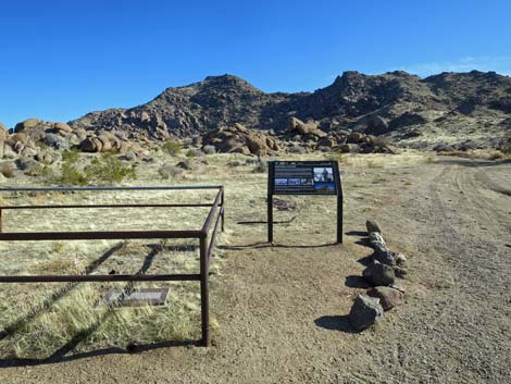
 Gold Butte Townsite Road (view S) |
Watch Out Other than the standard warnings about hiking in the desert, ... this area is fairly safe, but there are old mines around, and holes in the ground are never safe to enter. The access road requires a high-clearance vehicle or a carefully driven sedan. This is a wild and remote area without services of any kind (no restrooms, no water, no gas, no food). Bring what you need to survive. Be prepared and be self-reliant. Law enforcement occasionally patrols the area. Someone will find you eventually if you stay on a main road, but be prepared to survive alone for a day or two. Cell phones work only along parts of the paved road. While visiting, please respect the land and the other people out there, and try to Leave No Trace of your passage. Also, this is a remote hike, so be sure to bring the 10 Essentials. |
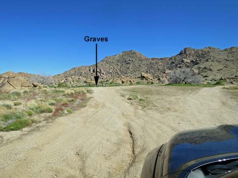
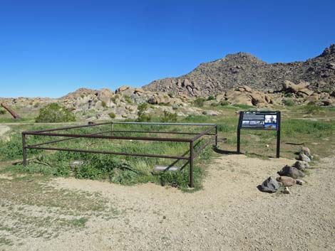
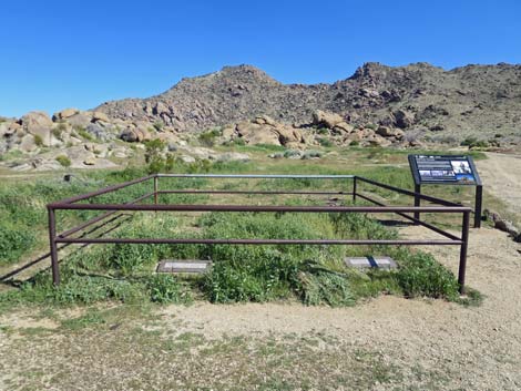
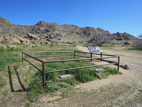
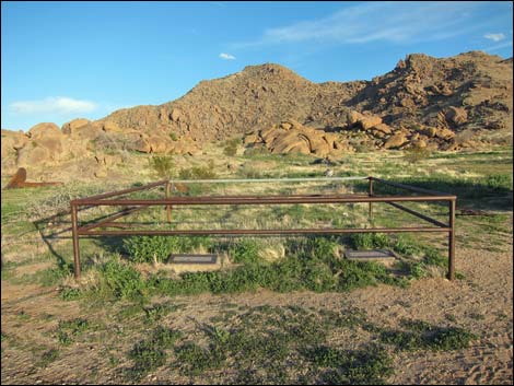
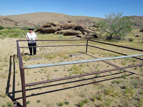
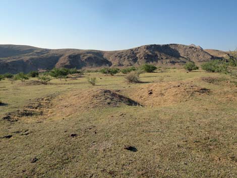
 Approaching graves of Arthur Coleman and William Garrett (view SE) |
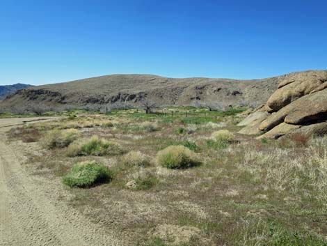
When exploring and finding interesting things, especially small things that fit in your pocket, please remember that this "junk" belongs to everyone, so leave it for your grandchildren to discover and enjoy. Also, these items are more than 50-years-old, and the historic site is so interesting that this area could someday be a registered as a National Historic Site. Trash is another matter; if you can, please help haul out trash left by other visitors. Getting to the Townsite Gold Butte Townsite is located out in Gold Butte National Monument at the northeast end of Lake Mead, about 3 hours northeast of Las Vegas in a wild, remote, and scenic area. |
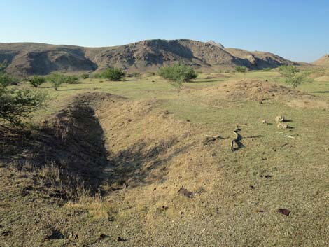
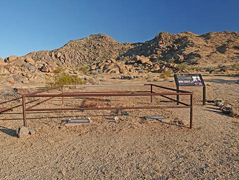 Graves of William Garrett and Arthur Coleman |
From town, drive out the paved Gold Butte Road for 21 miles to Whitney Pocket where the pavement ends. Continue south on the scenic unpaved Gold Butte Road for 19.8 miles a cattle guard that marks entry into the Gold Butte Townsite area. Continuing 20 yards past the cattle guard, Voight Well Road East (Table 1, 1650), on the left, leads into the Voight Well area (Site 1698 and Site 1699), which can be thought of as the east-most neighborhood in the town of Gold Butte. At about 280 yards past the cattle guard, Voight Well Road West (Site 1651) also leads back into the Voight Well Area. At about 0.43 miles past the cattle guard (20.2 miles total), Gold Butte Townsite Road East (Site 1648) forks left into the Townsite area, proper. Notice at this point a road sign for Red Bluff Spring Road (Site 0806) on the right several yards ahead. Angle left (southwest) onto Gold Butte Townsite Road East. In a few yards, the road runs through an old fenceline and into Gold Butte Townsite (Site 0460), proper, which is an open area about 110 yards wide. |
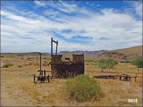
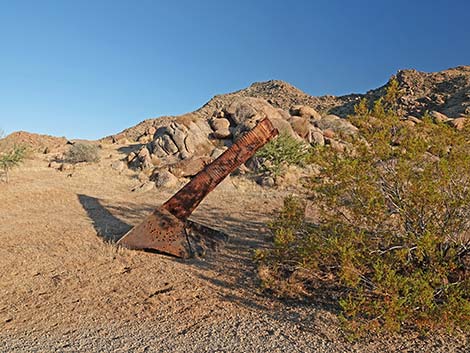
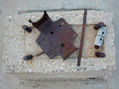
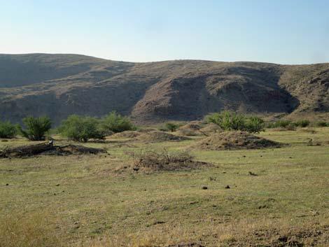
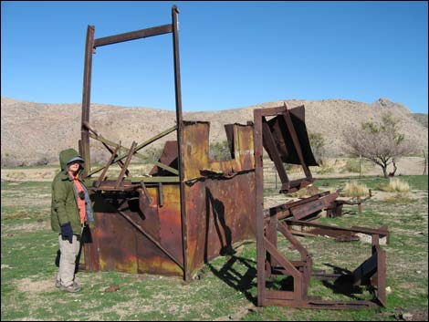 Old mining equipment |
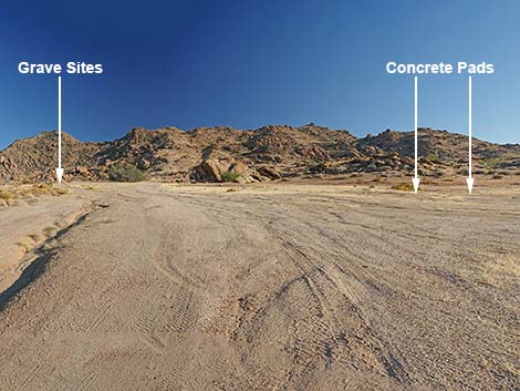
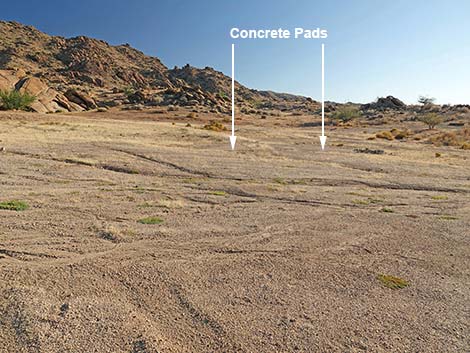
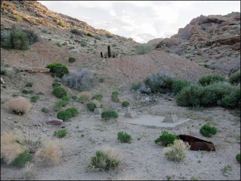
The Townsite The things that can be seen from the center of the large, cleared area are most of what remains. The grave sites of Arthur Coleman and William Garrett are on the southeast side of the cleared area, and the mine shaft (possibly a water well) and some rusting equipment lie on the west side. Two cement foundations can be seen near the center of the area. Around the area, the minor road leading southeast from the grave sites leads to the Gold Butte Lower Mines and the foundation of an old mill. Little remains, but these and other things can be found by exploring the area. The road leading southwest from the grate-covered mine shaft leads to several surface prospects. Other interesting things are scattered about: make it a treasure hunt and see what you can find. Old kitchen equipment, including a stove and refrigerator, lie southeast of the grave sites. Not much remains, but it is interesting to see what Garrett and Coleman had in their house. [Much of this has been removed in recent years.] |
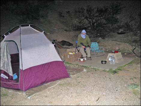
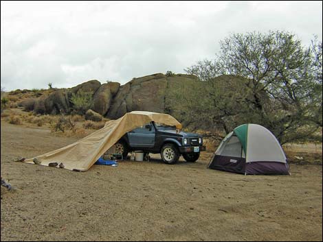 Wet campsite by the "big" trees at the Townsite |
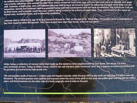
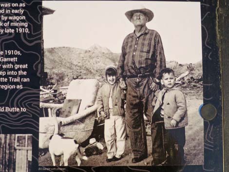
Miners extracted copper, gold, lead, and zinc from the surrounding mountains for several years, but the ore (including the mica) wasn't rich enough to ship profitably and the miners drifted away. A few miles north on Tramp Ridge, however, the Lincoln Mine produced enough copper to be worth working into the 1950s. Today Gold Butte Townsite is littered with evidence of mining, including mine shafts and adits (see Gold Butte Lower Mines), old equipment, the remains of old mills, can dumps, and cement foundations, but all of the buildings are gone. The graves of Arthur Coleman and William Garrett give silent testament to two men who lived together and worked the Gold Butte mines from about 1916 until they were too old to work anymore (they died in 1958 and 1961, respectively). They lived in a cabin that sat behind the grave sites, and were said to have been honest men, good cooks, and gracious hosts to anyone traveling this remote region. |
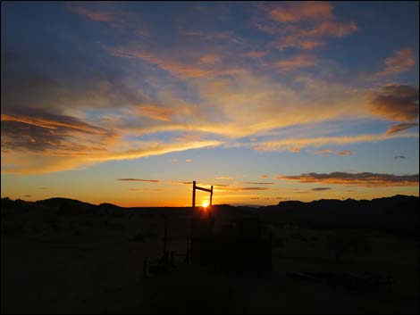 Sunset over the Townsite (view W) |
Longtime area resident and former owner of the Treasure Hawk Mine (on the other side of Gold Butte Peak), John Lear, says: Gold was discovered here after 1900, and by 1907, mining was going well the town of Gold Butte had a post office and a saloon, but few permanent buildings. They all had tents in those days because it was too tough to bring in wood to build houses. Gold Butte, which at one time had a population approaching 2,000, had only a brief period of glory. By 1909, the miners cleared out and the post office was closed because so few people remained in the region. Only "The Odd Pair," Bill Garrett and Art Coleman remained at Gold Butte and continued to work their mines. Bill Garrett was a tall Texan cowboy and an expert gunman, while Art Coleman, short and slight, was intellectual and of frail health. The two men arrived in the Gold Butte area about 1916, and for years, their cabin was a stopping place for travelers. They were known for their hospitality and for keeping their word. Excerpted from Desert Valley Times, David Bly, January 18, 2008; or snatch a PDF here). |
Vandalism -- don't do this!
 Historical fence post cut for firewood |
 Historical mining equipment used for target practice |
 Historical mining equipment used for target practice |
 This old cabin stove was stolen |
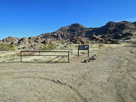
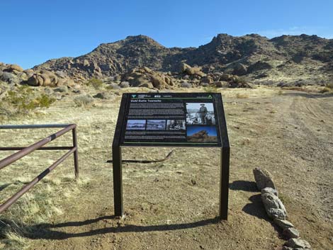
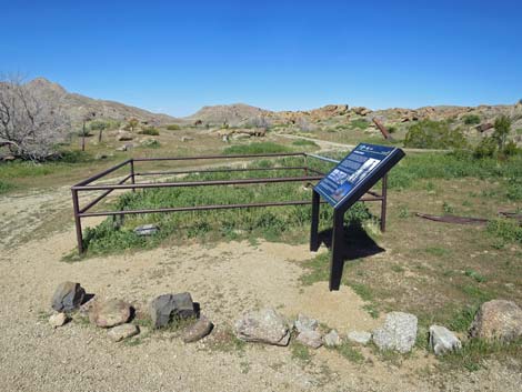
Gold Butte Townsite Information Sign
 |
 |
 |
 |
 |
 |
 |
 |
 |
 |
Coleman & Garrett Graves
 Coleman & Garrett grave site (view SE) |
 Coleman & Garrett grave site (view SE) |
 Coleman & Garrett grave site (view SW) |
 Coleman & Garrett grave site (view E) |
 Graves of Arthur Coleman and William Garrett during winter |
 Graves of Arthur Coleman and William Garrett during summer (view S) |
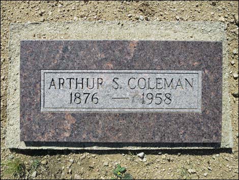 Grave marker for Arthur S. Coleman (summer 2016) |
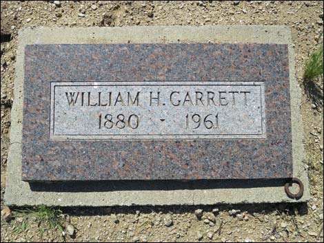 Grave marker for William H. Garrett (summer 2016) |
Coleman & Garrett Still
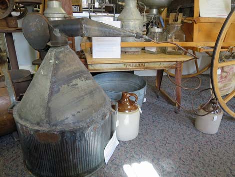 Coleman & Garrett Still (Virgin Valley Heritage Museum) |
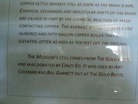 Info about Coleman & Garrett Still (Virgin Valley Heritage Museum) |
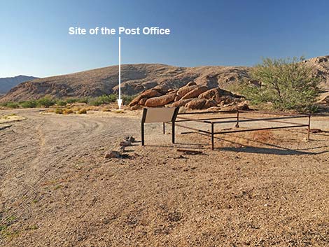
Post Office Site
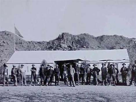 Gold Butte Post Office c. 1906 (Virgin Valley Heritage Museum) |
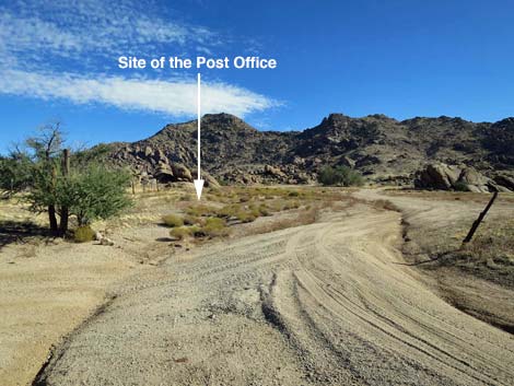 Site of the historical Post Office (view S entering the area) |
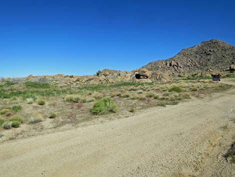 Site of the historic post office (view S from Townsite Road) |
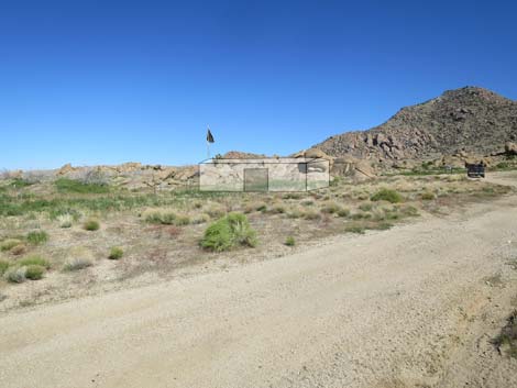 Ghost of Gold Butte post office (view SE from Townsite Road) |
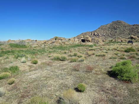 Site of the historic post office (view SE) |
 Site of the historic post office (view E) |
 Site of the historic post office (view N) |
 Site of the historic post office (view N) |
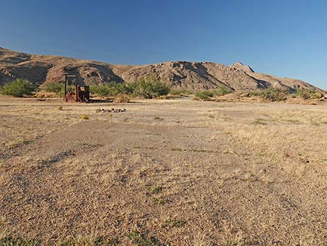
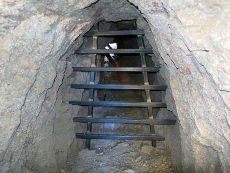
Mine Shaft Water Well
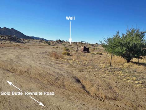 Well is at the west edge of the main Townsite area (view SW) |
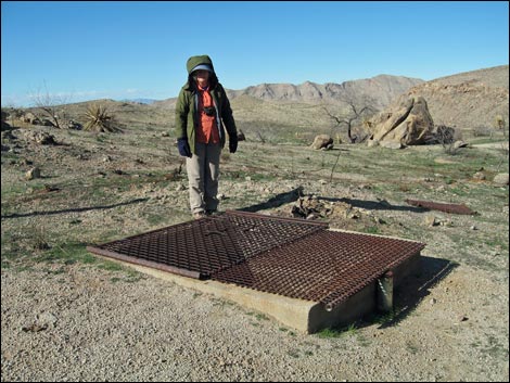 Metal grate over vertical mine shaft (view NW, winter) |
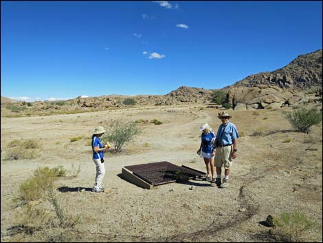 Metal grate over vertical mine shaft (view SE; summer) |
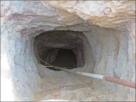 Water in the bottom of the mine shaft (view down) |
Homesite Debris (now removed -- don't take our heritage!)
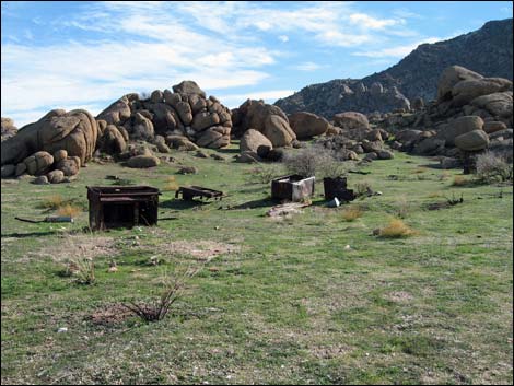 Old cabin equipment southeast of grave sites (removed) |
Old cabin stove (removed) |
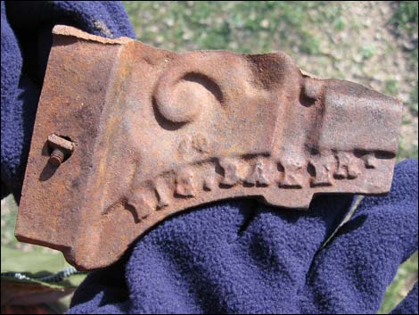 Big Baker? |
 Old cans (these are items of historic interest, not trash) |
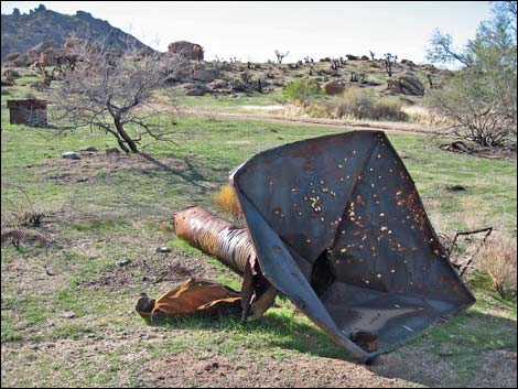
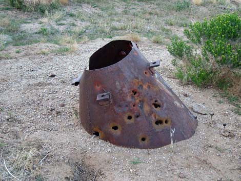
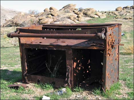
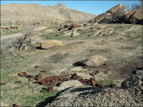
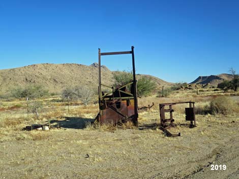
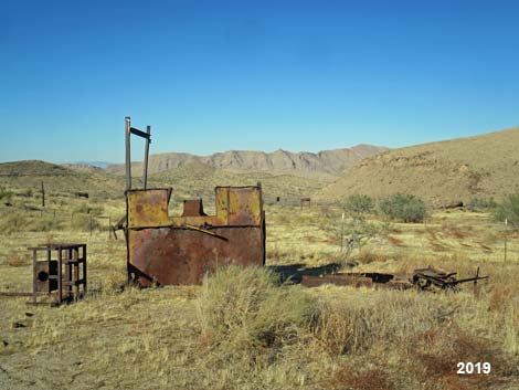
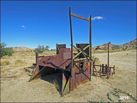
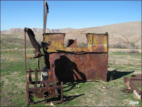
Historical Mining Equipment (not trash)
 Historical Mining Equipment (view SE) |
 Historical Mining Equipment (view SE) |
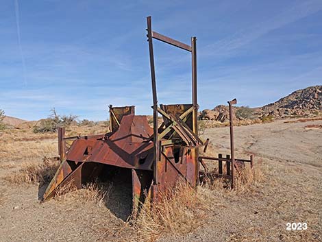 Historical Mining Equipment (view SE) |
 Historical Mining Equipment (view SE) |
 Historical Mining Equipment (view NE) |
 Historical Mining Equipment (view N) |
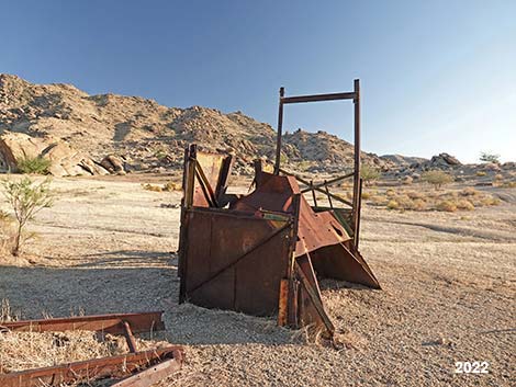 Historical Mining Equipment (view SE) |
 Historical Mining Equipment (view S) |
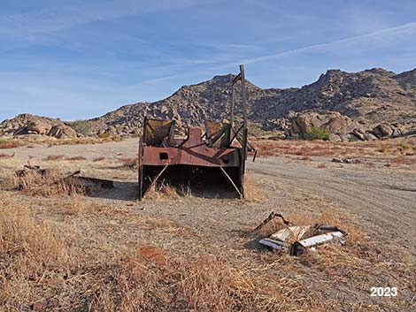
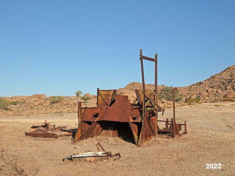
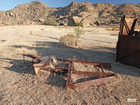
 Old equipment during fall (view NE) |
 Old equipment during summer (view W) |
 Old equipment during fall (view NW) |
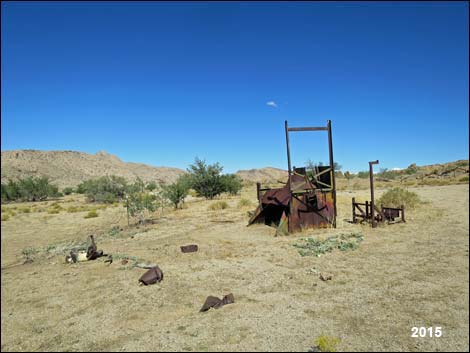 Old equipment during spring (view NW) |
 |
 |
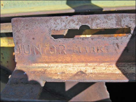 Junior Mark ... |
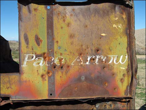 Pace Arrow |
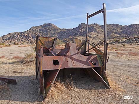
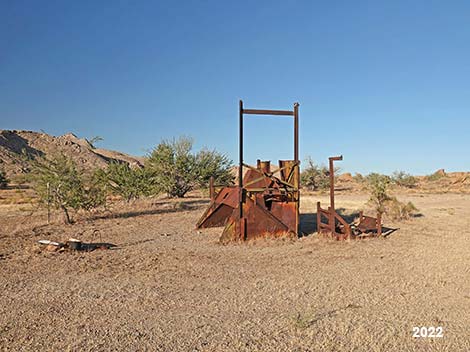
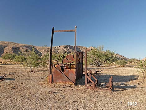
Old hopper |
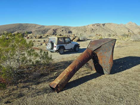 The old hopper seem to keep moving around |
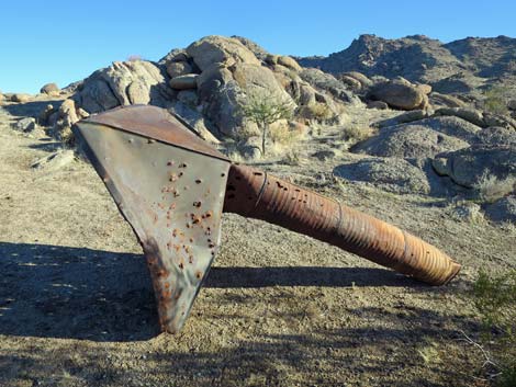 Old hopper |
 The old hopper continues moving around |
 Historical mining debris |
Historical mining equipment |
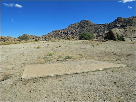
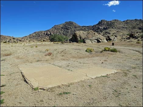
Concrete Pads. In a town of 2000 souls where everyone lived out of canvas tents with dirt floors, who had the money to bring in concrete? As we understand it, there were four "buildings" in downtown Gold Butte: post office, general store, saloon, and brothel. We know the post office had a dirt floor, so the choice is between the general store, saloon, and brothel. My guess is that the latter two were to only businesses bring in enough cash to waste some on concrete.
 Driving into the Townsite area (view SW) |
 Concrete Pads (view SW) |
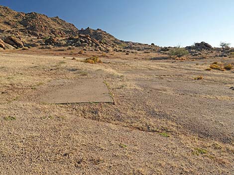 Concrete Pads (view SW) |
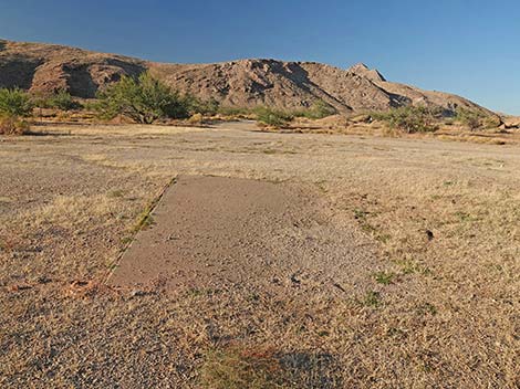 Concrete Pads (view NE) |
 Concrete Pads (view NE) |
 Two historical foundations (view SE) |
 Historical East foundation (view SE) |
 Historical West foundation (view SE) |
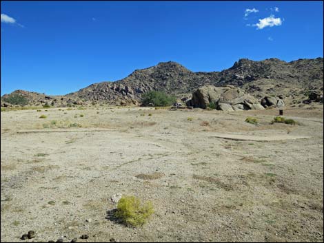
Some of the Old Gold Butte Mines
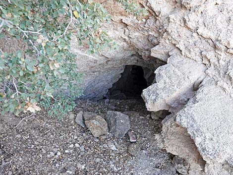 Another Gold Butte Lower Mine opening |
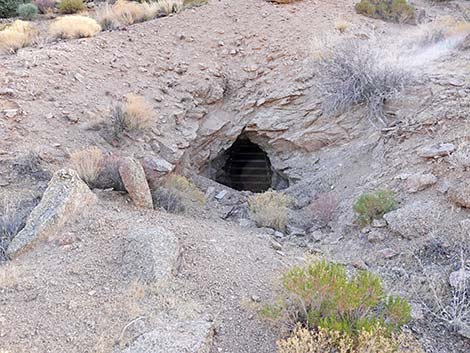 Gold Butte Lower Mine opening |
 Gold Butte Lower Mines and mill site (view SW) |
 Cold winter campsite at old mill site |
 Gold Butte Lower Mines and mill site (view N from above) |
 The mines are now gated |
1950s-era Placer Prospecting South of Gold Butte Road
 Across GB Road, prospectors explored for placer gold deposits |
 Across GB Road, prospectors explored for placer gold deposits |
 Across GB Road, prospectors explored for placer gold deposits |
 Across GB Road, prospectors explored for placer gold deposits |
Table 1. Highway Coordinates Based on GPS Data (NAD27; UTM Zone 11S). Download Highway GPS Waypoints (*.gpx) file.
| Site | Location | UTM Easting | UTM Northing | Latitude (N) | Longitude (W) | Elevation (ft) | Verified |
|---|---|---|---|---|---|---|---|
| 0460 | Gold Butte Townsite | 751564 | 4018463 | 36.28017 | 114.19926 | 3,749 | Yes |
| 0806 | Gold Butte Rd at Red Bluff Spring Road | 751471 | 4018545 | 36.28093 | 114.20028 | 3,705 | Yes |
| 1648 | Gold Butte Rd at GB Townsite Rd East | 751531 | 4018569 | 36.28113 | 114.19960 | 3,727 | Yes |
| 1650 | Gold Butte Rd at Voight Well Rd E | 752023 | 4019023 | 36.28510 | 114.19398 | 3,710 | Yes |
| 1651 | Gold Butte Rd at Voight Well Rd W | 751876 | 4018844 | 36.28352 | 114.19567 | 3,696 | Yes |
| 1698 | Voight Well Area | 752057 | 4018860 | 36.28362 | 114.19366 | 3,724 | Yes |
| 1699 | Gold Butte Peak Trailhead | 752256 | 4018822 | 36.28323 | 114.19145 | 3,743 | Yes |
Happy Hiking! All distances, elevations, and other facts are approximate.
![]() ; Last updated 240325
; Last updated 240325
| Hiking Around Gold Butte | Hiking Around Las Vegas | Glossary | Copyright, Conditions, Disclaimer | Home |