South Rim to Havasupai Garden (6,880 to 3,790 ft)
Hiking Around Las Vegas, Grand Canyon National Park
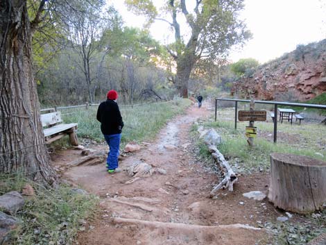
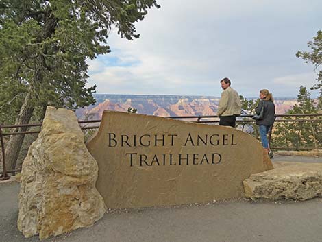 Bright Angel Trailhead sign during summer (view NE) |
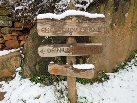
Overview The Upper Bright Angel (BA) Trail generally is well maintained and offers a fairly easy way to get below the rim and experience the feeling of being down inside the Grand Canyon. The first 2 miles include some steep parts, but the remaining miles, including those through the Redwall, are fairly gentle. From there, the trail runs at an easy grade to Havasupai Garden (IG). Below Havasupai Garden, the trail continues to the Colorado River and then the Bright Angel Campground at Phantom Ranch. For details of the lower section, see Lower Bright Angel Trail. Many airy places in the cliffs along the upper part of the trail provide sweeping views into the canyon. During spring through fall, water is available at the 1.5-Mile and 3-Mile Resthouses, and water is always available at Havasupai Garden. Toilets are available at all three places. During the mule-riding season, when droppings on the trail can make for a dusty mess, pay attention to instructions from the wranglers leading the trips; they probably will tell you to stand quietly on the uphill side of the trail while the mule train passes. Link to map. |
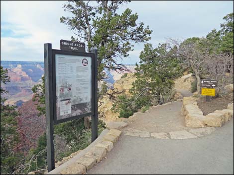 Bright Angel Trailhead information sign during summer (view NE) |
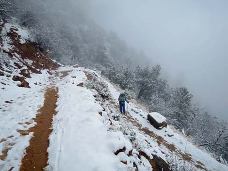
Watch Out Other than the standard warnings about hiking in the desert, ...this is a pretty safe trail if you stay on it, but there are many places where hikers could stumble off the trail into the abyss. The elevation at the South Rim is surprisingly high, about 7,000 feet, so take it easy if you are not used to the elevation. Don't be fooled by the cool summer temperatures on the rim; these temperatures quickly give way to scorching heat lower in the canyon. Trails here are made by putting down wooden cross-timbers, filling between the cross-timbers with rock rubble, and covering it all with dirt. The trail is easy to walk on when dry; but when wet, each crossbar makes a dam that holds a puddle of mud. While hiking, please respect the land and the other people out there, and try to Leave No Trace of your passage. This is a fairly long hike, so be sure to bring the 10 Essentials. Be sure that you are physically fit and that you choose routes of the appropriate difficulty for your skills and endurance. |
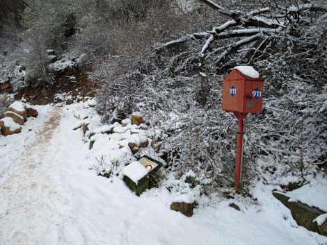
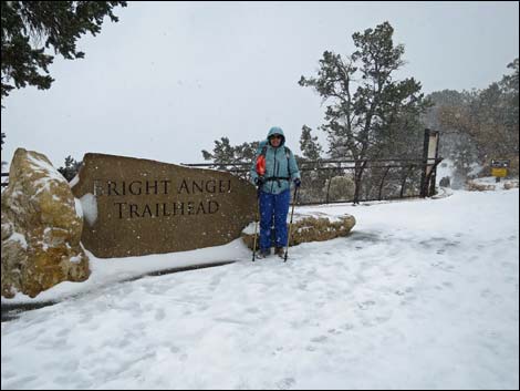 Bright Angel Trailhead sign during winter (view NE) |
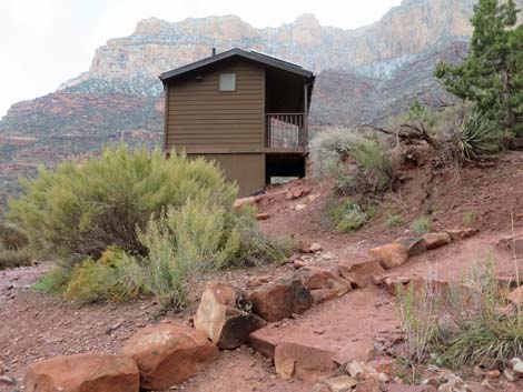
Getting to the Trailhead This hike is located on the South Rim of the Grand Canyon, about 5 hours southeast of Las Vegas. From town, drive out to the South Rim of Grand Canyon National Park. From the South Rim Visitor Center (Table 1, Site 0811), ride the shuttle bus or drive to the Bright Angel Lodge bus stop or the Village Transfer bus stop. The Bright Angel trailhead (Site 0814) is located on the rim of the canyon between these two shuttle bus stops. The trailhead is marked with signs and restrooms. The closest public parking is a few minutes walk to the southeast, across the road and the railroad tracks from the Bright Angel Lodge, but better parking is located at the backcountry office, where you pick up your permit, a few minutes walk from the rim. |
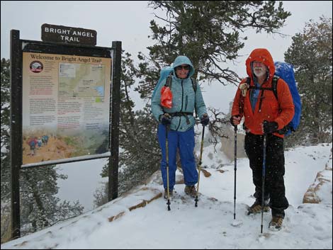 Bright Angel Trailhead info sign during winter (view NE) |
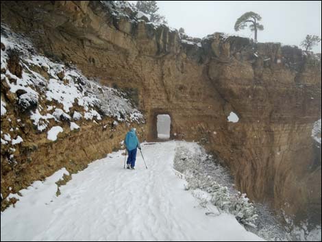
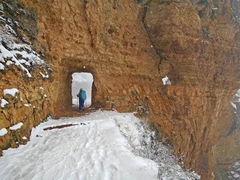
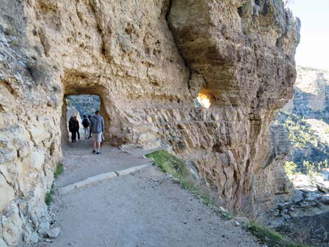
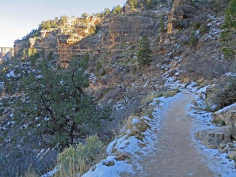
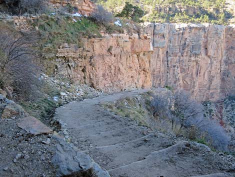
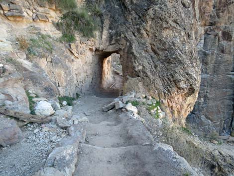
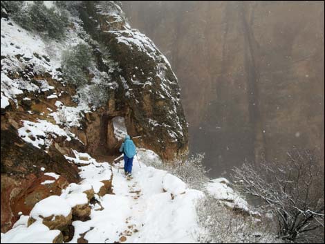
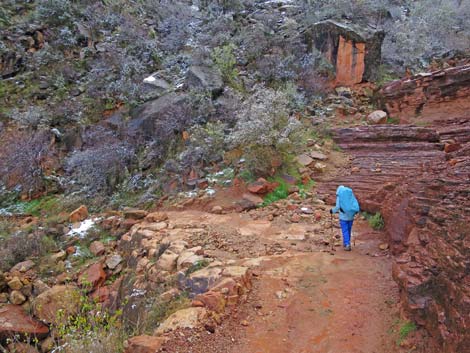
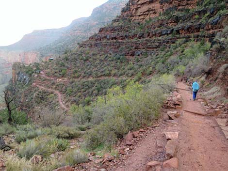
The Hike From the trailhead (Table 2, Wpt. 01), the trail immediately starts down into the canyon at a fairly easy grade. The trail starts by angling off to the east towards the lodges (and passes a fork in the trail to the Kolb Studio) before switchbacking left and heading west towards the First Tunnel (Wpt. 02), which is about 0.15 miles below the trailhead. Watch for petroglyphs and fossils on the rock walls near the tunnel. From First Tunnel, the trail continues westward as it curves toward the Second Switchback (Wpt. 03). There are some fairly steep parts on the trail through here. From the Second Switchback (Wpt. 03), the trail continues to the Second Tunnel (Wpt. 04). The trail remains fairly gentle and there are more nice views from the trail in this section. Beyond the Second Tunnel (Wpt. 04), the trail descends a number of short switchbacks at moderate grades. |
 Starting down into the canyon towards First Switchback (view NE) |
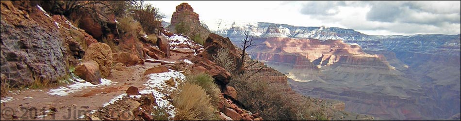
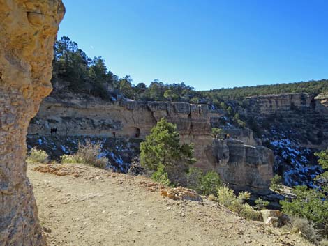
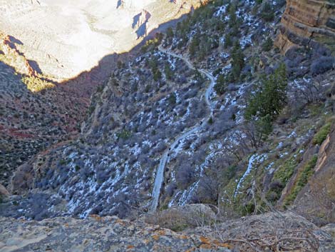
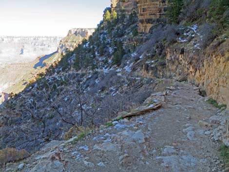
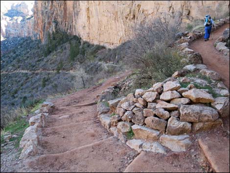
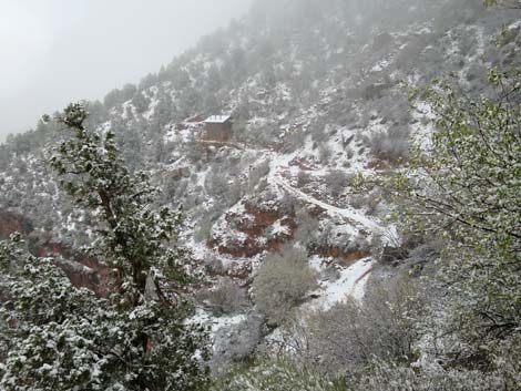
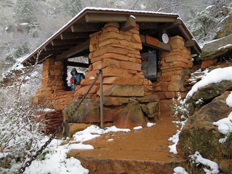
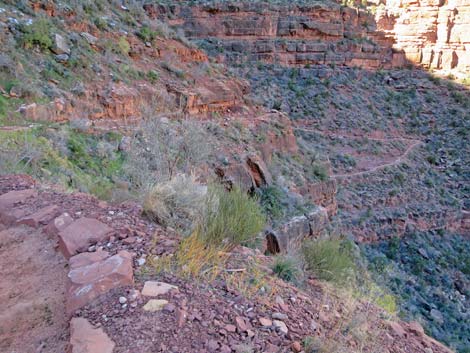
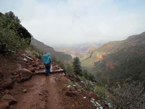
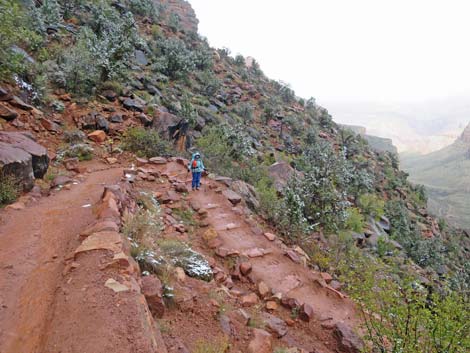
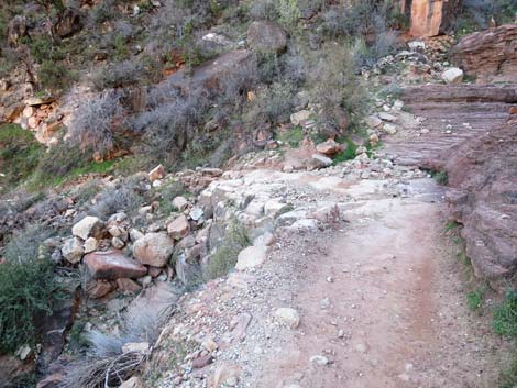
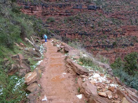
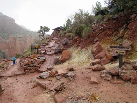
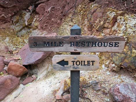
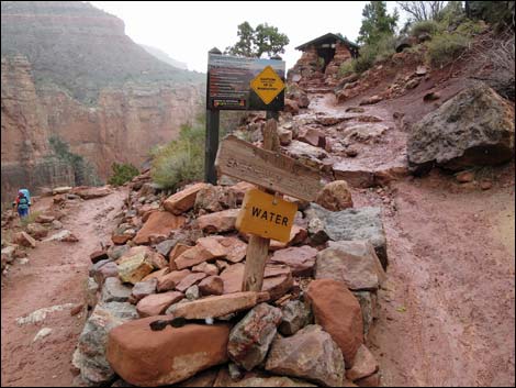
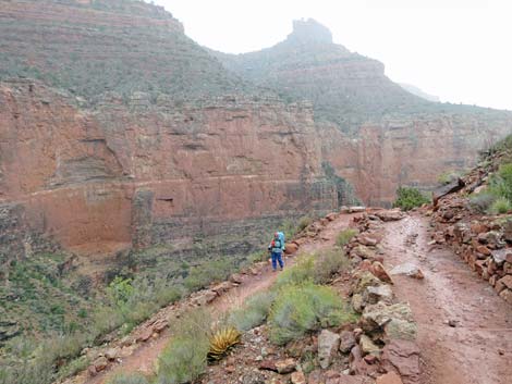
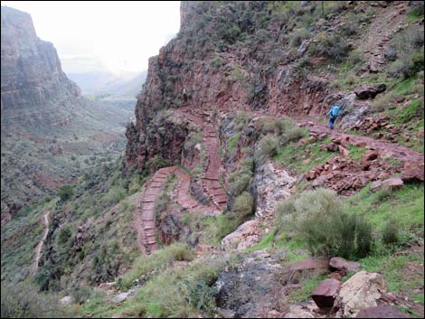
This section of trail drops through a gap in the Coconino Sandstone cliffs caused by the Bright Angel Fault. The layers on the west side of the fault are offset about 200 feet higher than those on the east side. Looking at rock layers in the back of the canyon, hikers will see that the rock layers are offset. Below the Coconino Sandstone, the trail makes a long arc to the east, ending at the 1.5-Mile Resthouse (Wpt. 05), which is 1.5 miles below the rim. Water is available seasonally at the resthouse, and there are restrooms off the next switchback (100 yards beyond the resthouse). From 1.5-Mile Resthouse, the trail makes a long gentle arc west, crossing the Bright Angel Fault and ending at 2-Mile Switchback (Wpt. 06). Here, 2.0 miles below the rim, watch for petroglyphs on rocks above the trail near the switchback. From 2-Mile Switchback (Wpt. 06), the trail makes a grand arc to the east (back across Bright Angel Fault), then winds down many switchbacks as it descends across the hillside to 3-Mile Resthouse (Wpt. 07). Water is available seasonally. The resthouse is located on a point of rock at the top of the Redwall Limestone. |
 Starting down into the canyon towards First Switchback (view NE) |
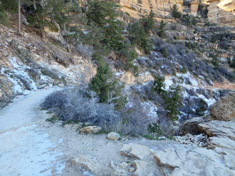
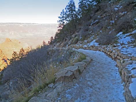
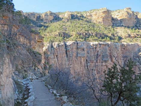
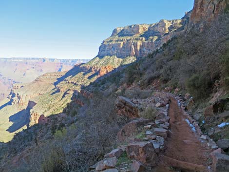
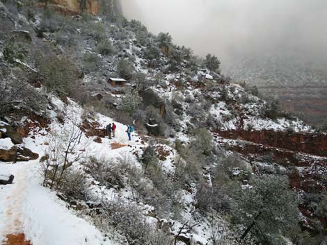
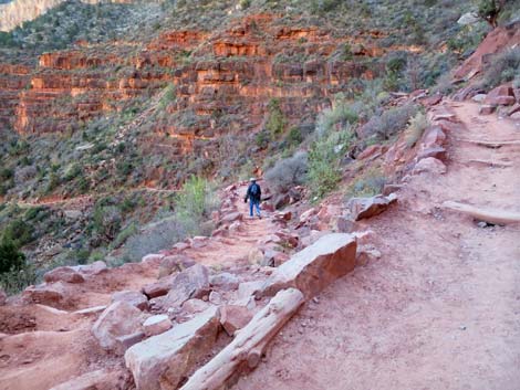
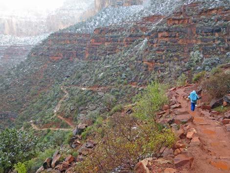
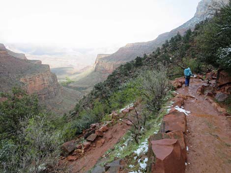
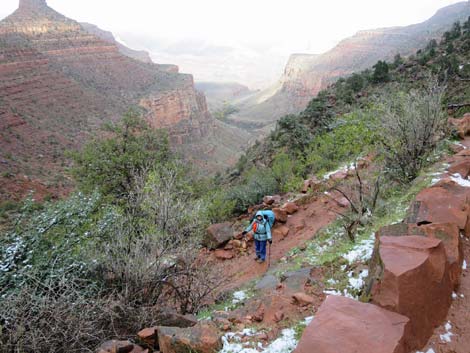
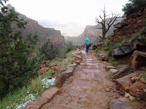
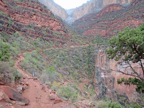
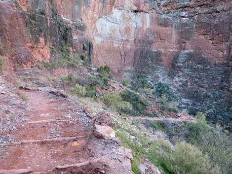
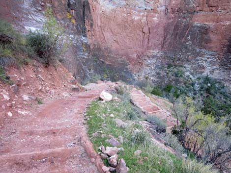
A short trail behind the resthouse leads to water, restrooms and an overlook with a great view into the canyon and the remains of an old cableway. The cableway was used to sling supplies and things, including cars, in and out of Havasupai Garden. The trip to 3-Mile Resthouse and back to the rim makes for a good 6-mile day-hike. Continuing past 3-Mile Resthouse (Wpt. 07), the trail runs down many short switchbacks through the Redwall Limestone cliffs and the Muav Formation. These switchbacks are in the back of the canyon, and although you get some nice up-close views of the Redwall, the views down the canyon are limited. Below the Redwall, the trail continues at a fair grade and contours into a side canyon (Wpt. 08). After coming out of the side canyon (Wpt. 08), the trail generally runs straight down Bright Angel Canyon along the east side of Garden Creek. This part of the trail runs on the Bright Angel Shale formation, which forms the top of the Tonto Platform, the wide bench on the edge of the inner canyon. |
 First Switchback below Kolb Studio (view NE) |
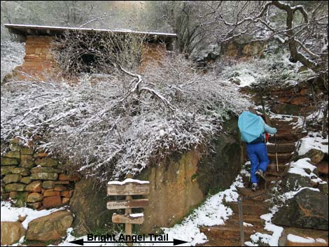
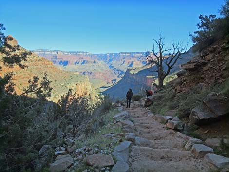
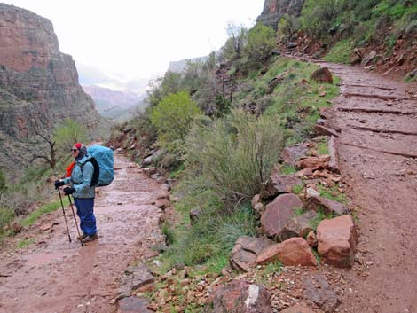
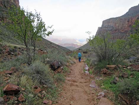
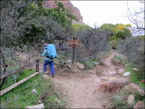
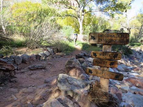
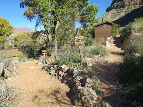
The grade is gentle the rest of the way into the Havasupai Garden Area. After a welcome to Havasupai Garden sign, hikers pass an unsigned use-trail to the left, which is the backway to the Havasupai Garden Ranger Station. Staying on the trail, hikers see the Havasupai Garden Ranger Station on the left, then arrive at Havasupai Garden Campground Trail junction (Wpt. 09), which is 4.6 miles below the rim. Turning left into the campground, the trail forks in about 20 yards. The left is the main trail to the Ranger Station, straight leads to campground toilets, and right runs down into the campground, proper. Continuing down Bright Angel Trail, hikers see campsites behind bushes on the left, then arrive at a mule tie-up area on the right. Shortly thereafter, a signed trail left leads into the bottom (north end) of the campground. |
 |
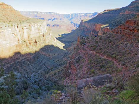
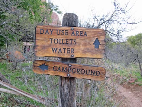
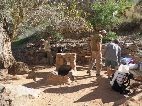
The old Havasupai Garden Ranger Station is located just below the campground on the left. Next are day-use restrooms on the right, then a rest area with benches, seasonal water, and information signs on the right and mule corrals on the left. This is also the Plateau Point trail junction (Wpt. 10). While resting, rodents (mostly Rock Squirrels) and Common Ravens can be a problem, so don't encourage them by giving handouts. Below Havasupai Garden, the lower Bright Angel Trail continues down to the Colorado River (8.0 miles from the rim), and the River Trail leads to Phantom Ranch (9.8 miles from the rim). From Havasupai Garden, other trails continue to the Tonto West and Tonto East trails (which run east-west through the canyon on the Tonto platform), and the Plateau Point Trail that runs out to the edge of the Inner Gorge (6.2 miles below the rim). From wherever you get to, return to the trailhead by the Bright Angel Trail or one of the other trails back to the rim. Don’t hike so far down that you can't get back out. |
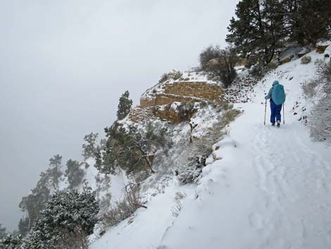
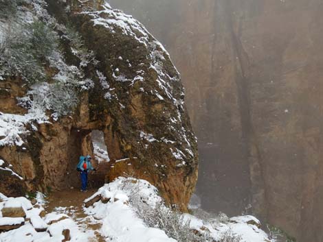
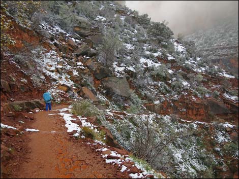
 Snow on trail in the Kaibab Limestone; First Tunnel (view W) |
 Hiker in First Tunnel with snow (view W) |
 Hiker in First Tunnel without snow (view W) |
 Cliffs here are steep and high (view down) |
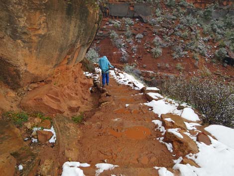
 Steep trail below the First Tunnel (view W) |
 Hiker passing Second Switchback (view W) |
 Second Switchback (view W) |
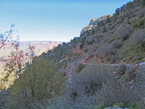
 Moderate grade on long arching trail (view NE) |
 Moderate grade on long curving trail (view NE) |
 Moderate grade on long curving trail (view NE) |
 Hiker at switchback below long curving trail (view NE) |
 Switchback below long curving trail without snow (view W) |
 Descending into the Coconino Sandstone (view W) |
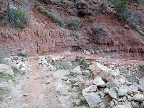
 Second Tunnel (view W) |
 Hiker approaching Second Tunnel (view W) |
 Hiker at Second Tunnel (view W) |
 Descending through a break in the Coconino Wall (view E) |
 Below the Coconino Wall (view NE) |
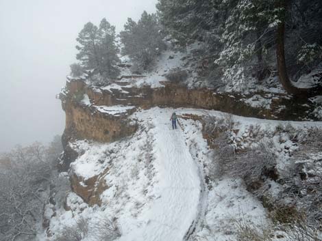
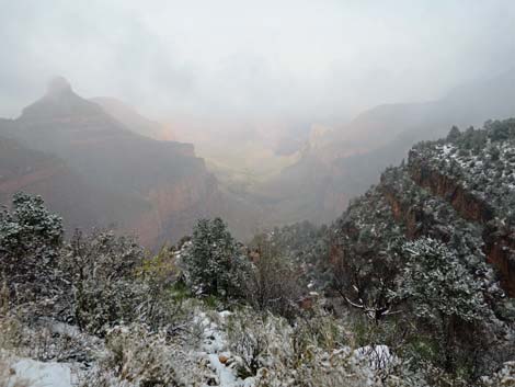 Grand view down Bright Angel Canyon during snow storm (view NE) |
 1.5-Mile Toilets in the distance (view E) |
 Stairs lead up to the 1.5-Mile Resthouse (view SE) |
 Hiker inside 1.5-Mile Resthouse (view SE from spur trail) |
 Trail signs |
 Emergency phone |
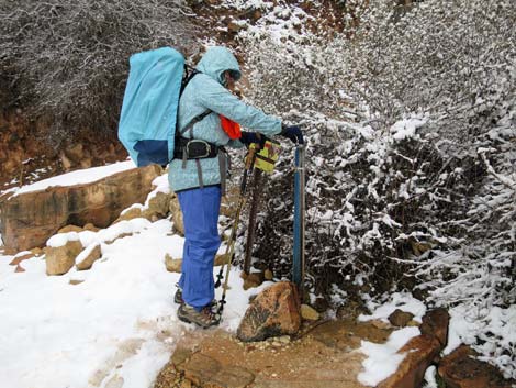 Hiker at water faucet |
 1.5-Mile Toilets in the distance (view E from Resthouse) |
 Trail below 1.5 Mile (view W from before 1.5 Mile Toilets Spur) |
 1.5-Mile Restrooms on short spur trail (view NE) |
 1.5-Mile Restrooms on short spur trail (view NE) |
 Hikers at BA - 1.5 Mile Toilet Spur Trail junction (view W from toilets) |
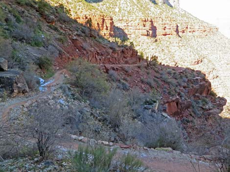
 Trail in the Supai (view W) |
 Trail in the Supai (view W) |
 Hiker on Bright Angel Trail (view W) |
 Hiker approaching Bright Angel Fault (view W) |
 Bright Angel Fault (view W) |
 Grand view down Bright Angel Canyon (view N) |
 Hiker at 2-Mile Switchback (view N) |
 Hiker below 2-Mile Switchback (view N) |
 Lots of trail ahead (view E) |
 Hiker crossing Bright Angel Fault for the second time (view E) |
 Bright Angel Fault (view E) |
 More switchback (view NE) |
 |
 |
 Cloudy day (view NE) |
 Sunny day (view NE) |
 Descending towards 3-Mile Resthouse (view NE) |
 Hiker descending towards 3-Mile Resthouse (view NE) |
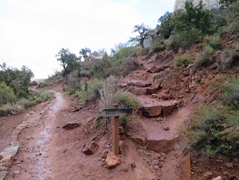
 Signs and spur trail to 3-Mile Resthouse (view NE) |
 3-Mile Resthouse signs (view NE) |
 3-Mile Resthouse atop the Redwall (view N) |
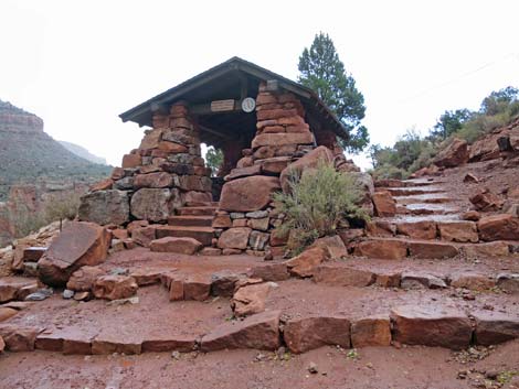 3-Mile Resthouse (view NE) |
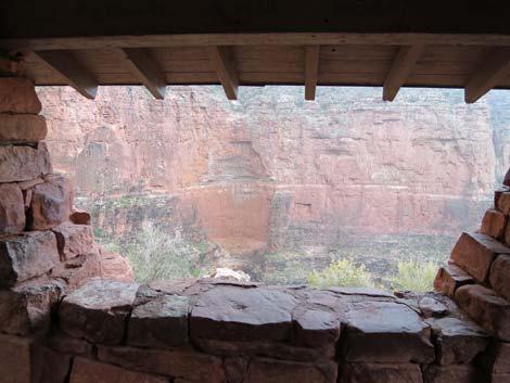 Inside 3-Mile Resthouse (view NW) |
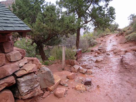 Water faucet behind 3-Mile Resthouse (view N) |
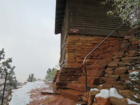
 Trails to 3-Mile Overlook and 3-Mile Restrooms (view N) |
 3-Mile Restrooms (view N) |
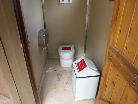 Inside 3-Mile Restrooms; some mud but pretty clean (view NW) |
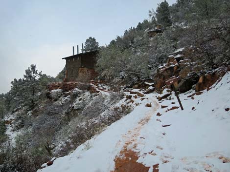
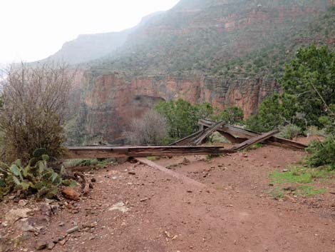 Remains of historic structure at 3-Mile Overlook (view NE) |
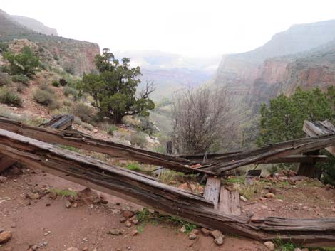 Remains of historic structure at 3-Mile Overlook (view NE) |
 View up and down trail (view SW from 3-Mile Resthouse) |
 Hiker descending past 3-Mile Resthouse (view N) |
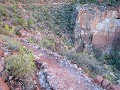 Starting down into the Redwall switchbacks (view SW) |
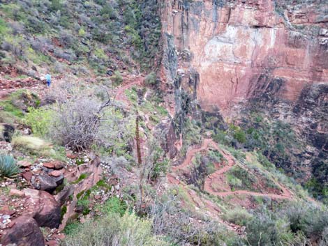 Hiker descending into the Redwall switchbacks (view SW) |
 Hiker on the Redwall switchbacks (view NE) |
 A bit of steep trial in the Redwall switchbacks (view SW) |
 Approaching last of the Redwall switchbacks (view SW) |
 Hiker at bottom of the Redwall switchbacks (view NE) |
 Below the Redwall (view NE down Garden Canyon) |
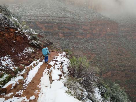
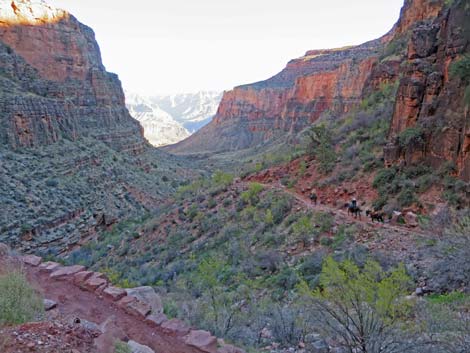
 Hiker descending gentle terrain in Bright Angel Canyon (view NE) |
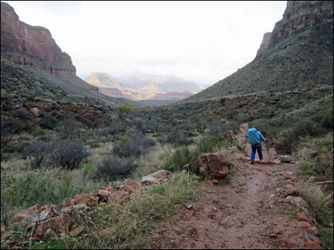 Bright Angel (BA) Canyon (view NW) |
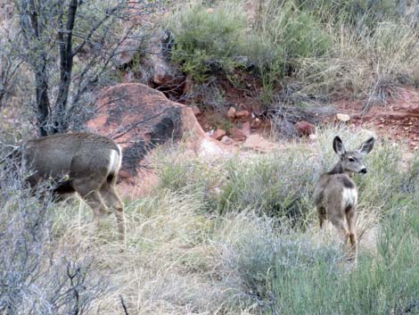 Desert Mule Deer along the trail |
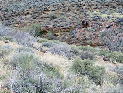 Desert Mule Deer below the trail |
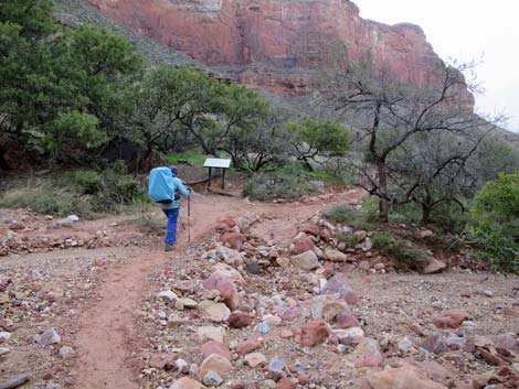 Hiker approaching Havasupai Garden (IG) area (view N) |
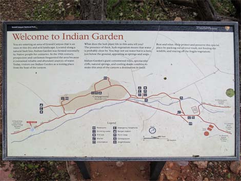 Sign with Havasupai Garden map and information (view NW) |
 Hiker at Havasupai Garden (view NE) |
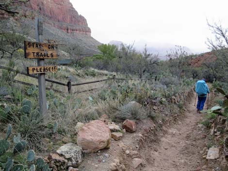
 Sign at edge of Havasupai Garden (view N) |
 Bright Angel Trail - Havasupai Garden Campground trail junction (view N) |
 Directional sign at BA Trail - IG Campground trail junction (view N) Directional sign at BA Trail - IG Campground trail junction (view N) |
 Hiker on BA Trail passing IG Campground (view N) |
 Hiker at mule "rest area" (view N) |
 Trail junction to north end of IG Campground (view N) |
 Bright Angel Trail at spur to IG day-use toilets (view NE) |
 Bright Angel Trail at IG day-use water faucet (view NE) |
 More to come ... |
Table 1. Highway Coordinates (NAD27, UTM Zone 12S). NOTE: This is UTM Zone 12. Download Highway GPS Waypoints (*.gpx) file.
| Site | Location | Latitude (°N) | Longitude (°W) | UTM Easting | UTM Northing | Elevation (feet) | Verified |
|---|---|---|---|---|---|---|---|
| 0811 | Visitor Center, Canyon View Information Plaza | 36.0590 | 112.1085 | 400166 | 3990857 | 7,092 | Yes |
| 0814 | Bright Angel Trailhead | 36.0574 | 112.1429 | 397067 | 3990721 | 6,870 | Yes |
Table 2. Hiking Coordinates and Distances based on GPS Data (NAD27; UTM Zone 11S). NOTE: This is UTM Zone 12S.
Download Hiking GPS Waypoints (gpx) file.
| Wpt. | Location | UTM Easting | UTM Northing | Elevation (ft) | Point-to-Point Distance (mi) | Cumulative Distance (mi) |
|---|---|---|---|---|---|---|
| 01 | Bright Angel trailhead | 397067 | 3990721 | 6,880 | 0.00 | 0.00 |
| 02 | First Tunnel | 397032 | 3990731 | 6,788 | 0.15 | 0.15 |
| 03 | First Big Switchback | 396802 | 3990896 | 6,873 | 0.24 | 0.39 |
| 04 | Second Tunnel | 396957 | 3990893 | 6,160 | 0.46 | 0.85 |
| 05 | 1.5-Mile Resthouse | 397464 | 3991050 | 5,700 | 0.73 | 1.58 |
| 06 | 2-Mile Switchback | 397196 | 3991309 | 5,440 | 0.44 | 2.02 |
| 07 | 3-Mile Resthouse Junction | 397736 | 3991599 | 4,700 | 1.01 | 3.03 |
| 08 | Side Canyon | 397953 | 3991736 | 4,400 | 0.72 | 3.75 |
| 09 | Havasupai Garden Trail Junction | 398399 | 3992794 | 3,790 | 0.82 | 4.57 |
| 10 | Plateau Point Trail Junction | 398562 | 3993031 | 3,771 | 0.19 | 4.76 |
| 11 | Tonto East Trail Junction | 398812 | 3993417 | 3,652 | 0.32 | 5.08 |
| 12 | Devil's Corkscrew Top | 399751 | 3994272 | 3,303 | 1.01 | 6.09 |
| 13 | Pipe Creek | 399974 | 3994080 | 2,792 | 0.83 | 6.92 |
| 14 | River Resthouse | 400054 | 3995190 | 2,480 | 0.96 | 7.88 |
| 15 | River Trail Junction | 400024 | 3995242 | 2,382 | 0.04 | 7.92 |
| 16 | Pipe Creek Beach | 400050 | 3995328 | 2,440 | [0.06 x 2] | . |
| 17 | View of Silver Bridge | 400718 | 3995367 | 2,520 | 0.56 | 8.48 |
| 18 | Silver Bridge, South End | 401429 | 3995058 | 2,450 | 0.68 | 9.16 |
| 19 | Silver Bridge, North End | 401461 | 3995209 | 2,463 | 0.09 | 9.25 |
| 20 | Bridge, BA Creek Lower | 401593 | 3995346 | 2,470 | 0.16 | 9.41 |
| 21 | Bright Angel Campground | 401416 | 3995539 | 2,480 | 0.25 | 9.66 |
Happy Hiking! All distances, elevations, and other facts are approximate.
![]() ; Last updated 240326
; Last updated 240326
| Hiking the Grand Canyon | Hiking Around Las Vegas | Glossary | Copyright, Conditions, Disclaimer | Home |