Hiking Around Las Vegas, Red Rock Canyon National Conservation Area
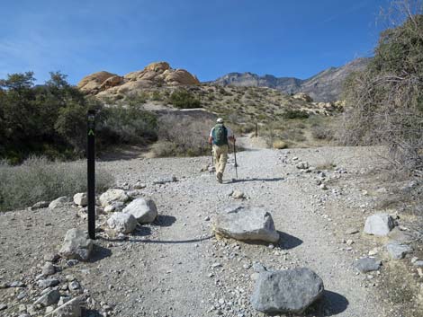
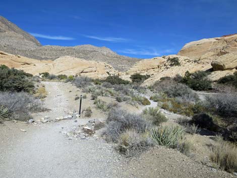
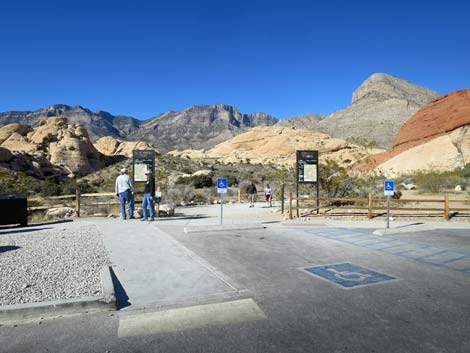 Sandstone Quarry North Trailhead (view N) |
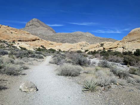
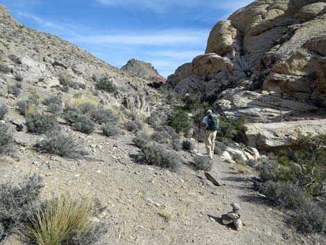
Overview Calico Hills Loop Trail is 6.5-mile hike that circumnavigates the Calico Hills. The hike can be considered a series of trail segments that start and stop at any of 6 trailheads (3 along the Scenic Loop Road and 3 in Calico Basin). Most of the loop runs on easy, gently sloping trails, but there are a few steep parts, some off-trail in a wash, and the Ash Canyon segment requires a fair bit of Class-2 and Class 3 scrambling getting down and around boulders and pour-overs. Views from many parts of the loop are grand, with those on the west side of the hills spreading out across all of Red Rock Canyon, and those on the east side looking southeast across Calico Basin and points south. For hikers who have only driven along the Scenic Loop Road, this hike offers an up-close and personal encounter with the Calico Hills that is quite different from the road-side perspective. Link to map. |
 Calico Hills Loop follows Calico Tank Trail (view NW) |
Watch Out Other than the standard warnings about hiking in the desert, ...this hike is fairly safe and usually not far from a road or trailhead. Ash Canyon requires a bit of Class 3 scrambling, so be extra careful when high enough to fall and get hurt. While hiking, please respect the land and the other people out there, and please try to Leave No Trace of your passage. This is a long hike, so be sure to bring what you need of the 10 Essentials. The Ash Canyon segment of the loop goes into the La Madre Mountain Wilderness Area, so pay particular attention to respecting the land. |
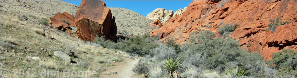
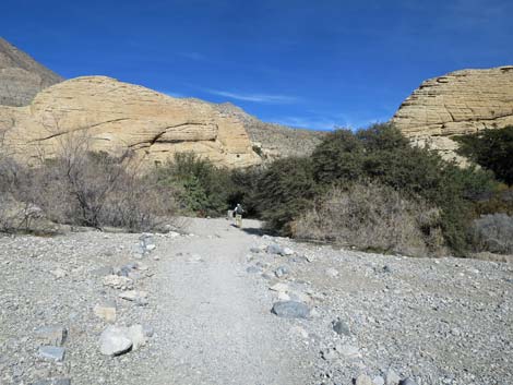
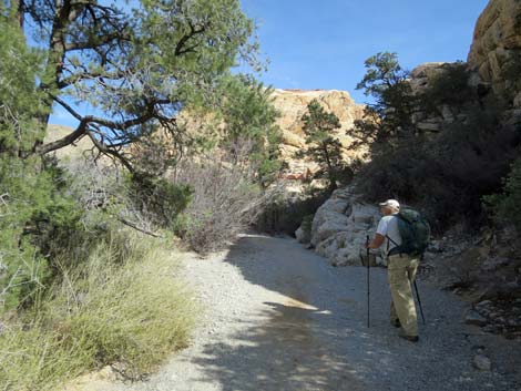
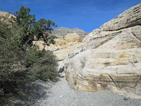
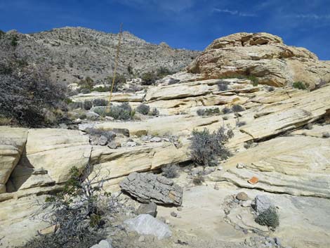
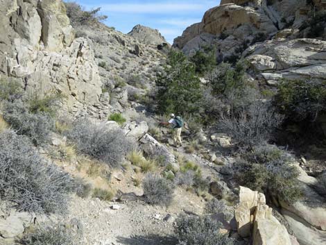
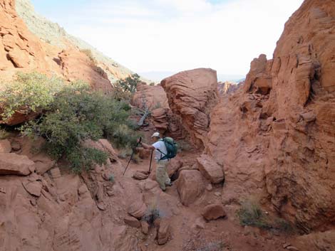
 Hiker passing the quarry stones (view NW) |
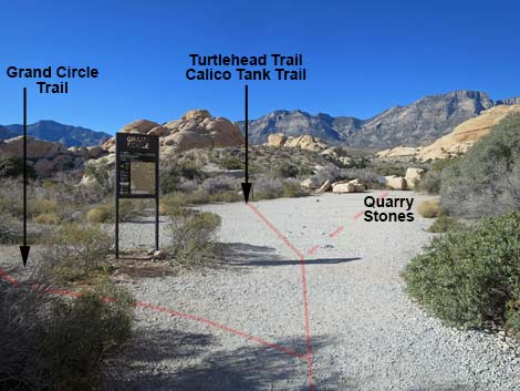
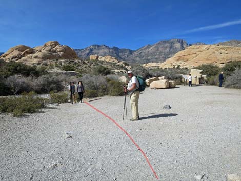
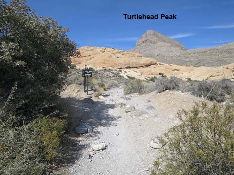
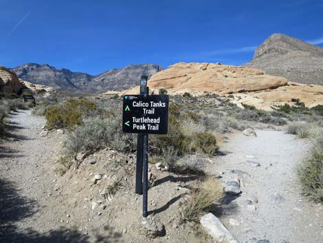
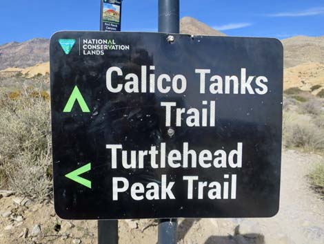
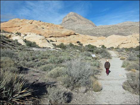
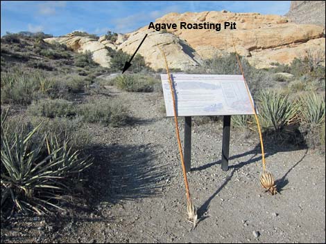
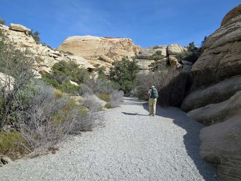
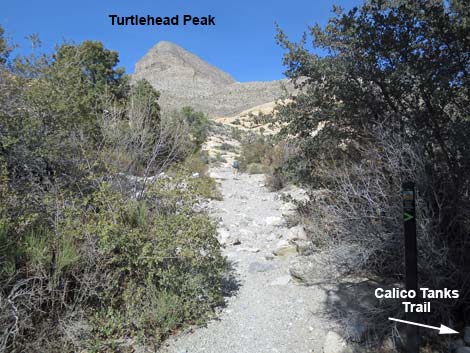
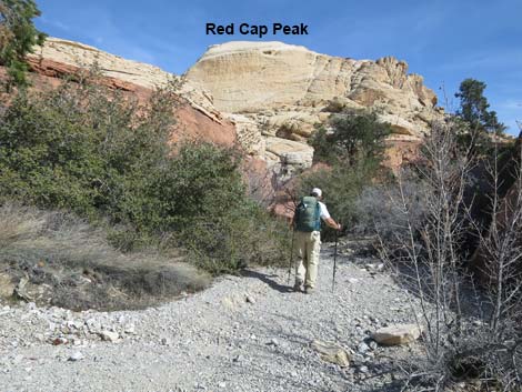
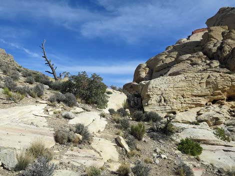
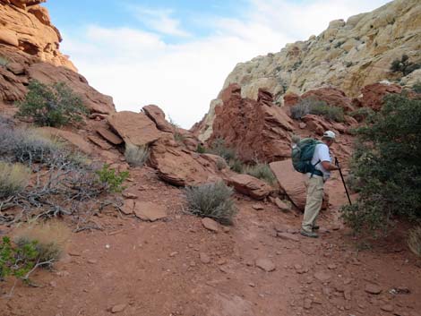
The Hike - Sandstone Quarry to Ash Canyon The Calico Hills Loop Trail continues north from the Sandstone Quarry north trailheads (by the vault toilets) following the Calico Tanks Trail (Wpt. 15). An old road runs north above a broad wash and below towering red and white sandstone cliffs, and is flanked by thickets of Shrub Live Oak and Pointleaf Manzanita. Passing out of the shrub thicket, the trail enters the open historical quarry area and immediately passes a signed trail junction to the Grand Circle Trail (Wpt. 16) on the left. The trail then passes the leftover quarry stones, on the right, and passes a Calico Tanks Trail sign (Wpt. 17) as it drops into the broad wash. Continuing north across the wash, the trail stays right at the signed Turtlehead Peak Trail junction (Wpt. 18) and now heading northeast, starts to wrap around the north end of the Calico Hills. The trail passes an info sign about agave roasting pits, drops back into the wash, and runs up into a narrow sandstone canyon through an area of dense Canyon Live Oak and other evergreen shrubs (e.g., Ashy Silktassel). |
 Calico Hills Loop follows Calico Tank Trail across wash (view NW) |
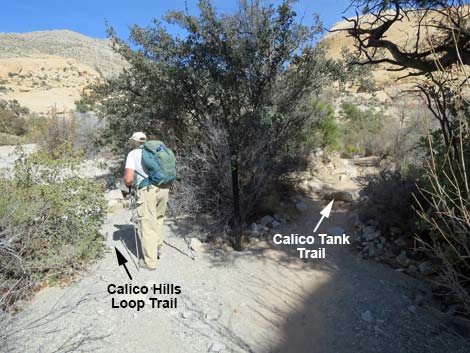
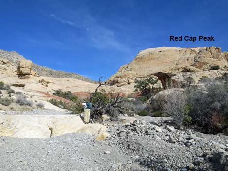
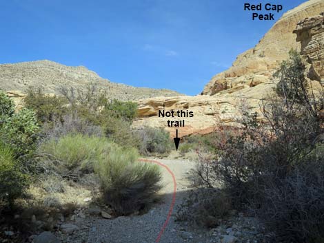
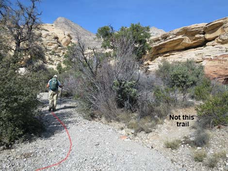
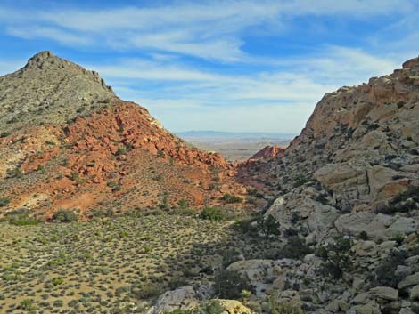
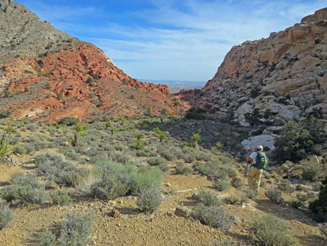
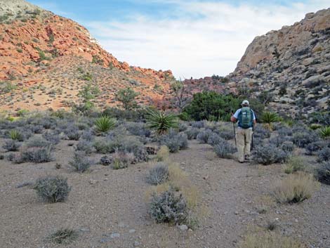
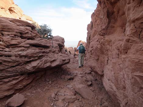
When the narrows begin to open, the Calico Tanks Trail turns out of the main wash (Wpt. 19) to the right heading southeast up into Calico Tanks Canyon, but the Calico Hills Loop Trail (now just a route) stays left in the wash heading northeast. This is an easy trail junction to miss because trail crews try to block hikers on the Calico Tanks Trail from accidentally turning left and getting lost. Following the wash, the route initially heads straight towards Turtlehead Peak. Hikers will need to do some route finding in this area, but in general, the route runs northeast threading between jumbled sandstone outcrops for about 0.3 miles (600 yards). The goal in this area is to get onto the low, limestone ridge off the northeast corner of Red Cap Peak (the broad white sandstone crag with the small red sandstone cap, seen ahead on the right). Except for the white narrows, the route is entirely walking, so if hikers get into any scrambling, there is an easier route. From the Calico Tanks Trail trail junction (Wpt. 19), the Calico Hills Loop Trail heads northeast up the gravel wash. The wash bends right to run due east and passes a large side wash (looks like a gravel road merging from the left) that merges from the left. Now heading due east towards Red Cap Peak, the route enters a short red-sandstone narrows. |
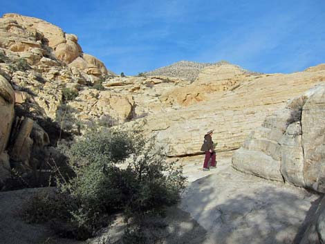
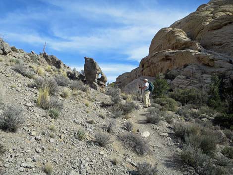
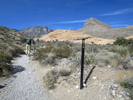 Calico Hills Loop follows Calico Tank Trail (view NW) |
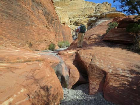
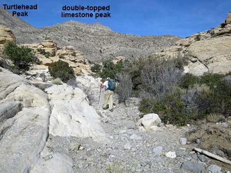
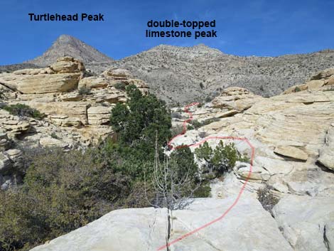
Shortly beyond the red narrows, the main wash turns hard to the left and passes a minor wash to the right with a use-trail that leads southeast to Red Cap Peak. Heading north, the route squeezes past some Shrub Live Oak bushes and beneath two Pinyon Pine trees, then abruptly turns right (Wpt. 20) and runs up into white-sandstone narrows with some short, but interesting scrambling to pass potholes that sometimes are full of water. Beyond the white narrows, which run southeast, the wash bends left to run northeast following a long, straight break between the sandstone crags. The route would be simple except that parts of the break are narrow and filled with pine trees, oaks, and other bushes, which encourages hikers onto the slickrock to the right. Even so, the route continues northeast heading a bit to the right of Turtlehead Peak (aim for a low, double-topped limestone peak). Continuing up the break, the route eventually runs off the white sandstone and onto gray limestone stones and gravels where a trail suddenly becomes apparent. The trail starts heading straight up the hillside, but quickly turns right and angles up across the slope. |
 Approaching Turtlehead Peak--Calico Tank trail junction (view N) |
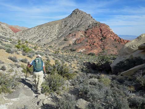
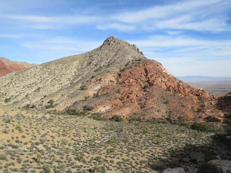
The trail climbs to a highpoint (Wpt. 21) where the trail crosses off sandstone and onto limestone; this is the Keystone Thrust Fault, seen elsewhere on the Keystone Thrust Trail. This marks, and more-or-less, the north-most point on the loop. Continuing along the limestone side of the sandstone-limestone boundary, the trail runs southeast below Red Cap Peak, climbing at a gentle grade, and enters the La Madre Mountain Wilderness Area (watch for the carsonite sign propped up in a Utah Juniper tree). The trail continues up and across the slope until reaching a highpoint as it passes along the north edge of a white sandstone crag, the top of which makes a nice rest stop. The trail loops around the top edge of the crag, then begins down along the east side and quickly reaches a trail junction with the Gray Cap Peak route (Wpt 22). Staying to the right, the trail drops directly towards the top of Ash Canyon to another trail junction (Wpt 23) that forms a triangle with the Gray Cap Peak route. From there, the Loop Trail continues southeast onto the broad, open red-dirt area at the top of Ash Canyon. |
 Turtlehead Peak--Calico Tank trail junction (view N) |
 Stay right (not straight) onto Calico Tank Trail (view N) |
 Calico Hills Loop follows Calico Tank Trail (view NE) |
 Hiker approaching Agave Roasting Pit exhibit sign (view NE) |
 Agave Roasting Pit exhibit sign (view N) |
 Calico Tank Trail departs old road into wash (view NE) |
 Trail in the wash heading towards gap in the rocks (view E) |
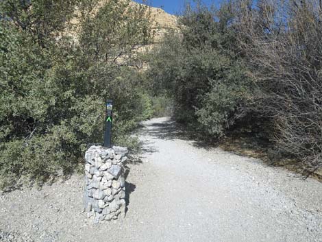 Trail marker and oak trees (view E) |
 Calico Tank Trail follows wash into the gap in the rocks (view E) |
 Calico Tank Trail continues up the wash (view E) |
 Calico Hills Loop departs Calico Tank Trail at trail marker (view NE) |
 Calico Hills Loop turns towards Turtlehead Peak (view N) |
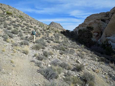
 Calico Hills Loop follows the gravel wash (view NE) |
 Calico Hills Loop follows the gravel wash (view NE) |
 Calico Hills Loop Trail runs through a bit of red narrows (view NE) |
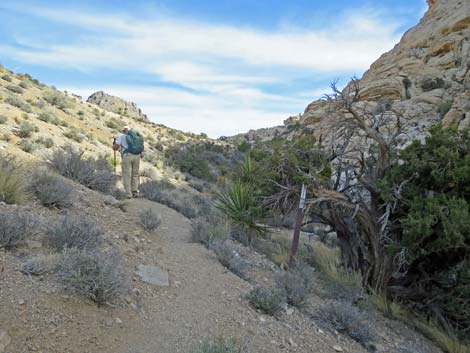
 Beyond red narrows, trail follows the gravel wash (view NE) |
 Trail follows the gravel wash (view N) |
 Trail follows the gravel wash past Pinyon Pine trees (view NE) |
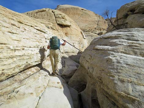
 Calico Hills Loop Trail turn into white narrows (view NE) |
 Hiker in the white narrows (view SE) |
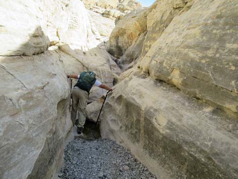 Hiker in the white narrows (view SE) |
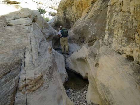 Hiker in the white narrows (view SE) |
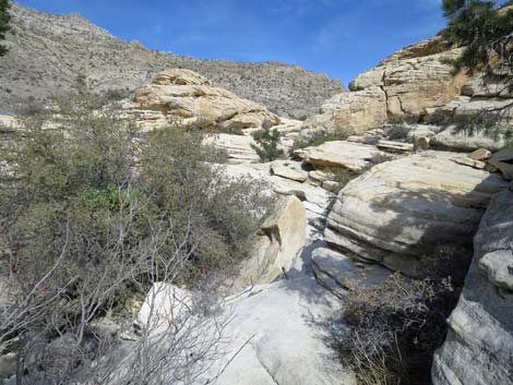
 Beyond the white narrows, route continues up the wash (view NE) |
 Trees in the wash force hikers onto the rocks (view NE) |
 Trees in the wash force hikers onto the rocks (view NE) |
 The Calico Hills Loop Trail continues across rocky terrain (view NE) |
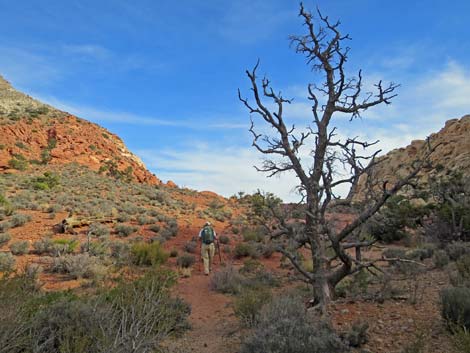
 The route climbs towards a dead tree on a saddle (view SE) |
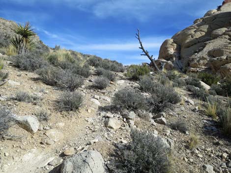 Calico Hills Loop Trail approaching dead tree on a saddle (view SE) Calico Hills Loop Trail approaching dead tree on a saddle (view SE) |
 Past the dead tree, the trail drops back into the wash (view SE) |
 Hiker on trail in the wash (view SE) |
 Curious rock with an apparent eye (view SE) |
 The trail climbs at gentle grades above the wash (view SE) |
 Hiker entering the La Madre Wilderness Area (view SE) |
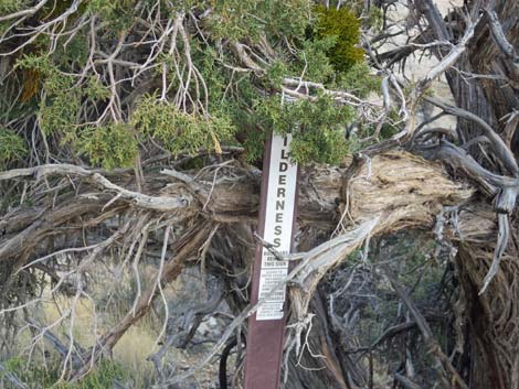 La Madre Wilderness Area sign (view SE) |
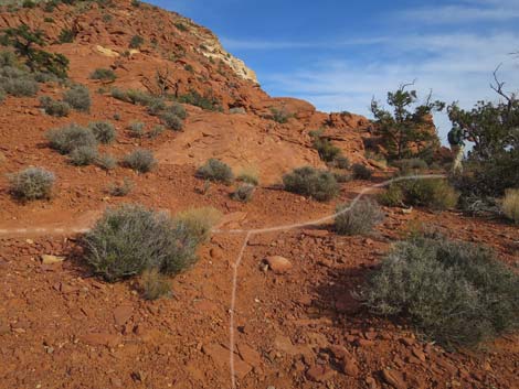
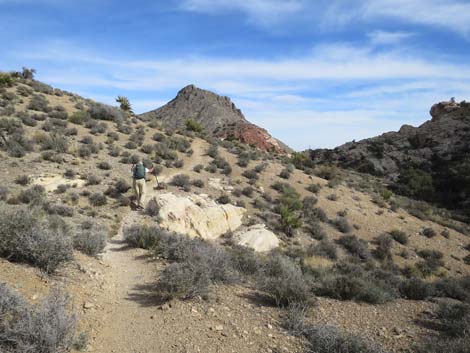 Calico Hills Loop Trail traversing gentle hillsides (view SE) |
 Calico Hills Loop Trail traversing gentle hillsides (view SE) |
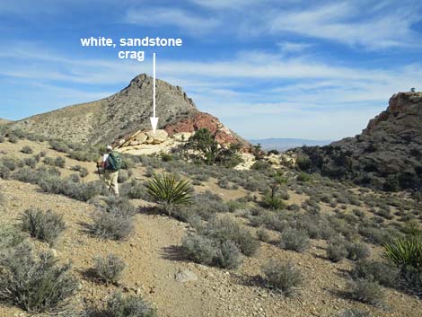
 Calico Hills Loop Trail passing white sandstone outcrop (view SE) |
 Nice example of thrust faulting (limestone over sandstone; view SE) |
 The top of Ash Canyon (view SE into Las Vegas) |
 Hiker descending towards Ash Canyon (view SE) |
 Hiker on faint trail approaching Ash Canyon (view SE) |
 Faint trail passes skeleton of a Pinyon Pine tree (view SE) |
 Faint trail merges with a well-used trail above Ash Canyon (view SE) |
 Hiker approaching entrance to Ash Canyon (view SE) |
 Hiker at entrance to Ash Canyon (view SE) |
 Hiker beginning descent into Ash Canyon (view SE) |
Table 1. Hiking Coordinates Based on GPS Data (NAD27; UTM Zone 11S). Download Hiking GPS Waypoints (*.gpx) file.
| Wpt. | Location | UTM Easting | UTM Northing | Elevation (ft) | Point-to-Point Distance (mi) | Cumulative Distance (mi) |
|---|---|---|---|---|---|---|
| 15 | Sandstone Quarry North Trailhead | 639468 | 4002876 | 4,367 | 0.07 | 3.06 |
| 16 | Grand Circle Trail Junction | 639474 | 4002987 | 4,305 | 0.07 | 3.13 |
| 17 | Calico Tanks Trail Junction | 639461 | 4003002 | 4,311 | 0.02 | 3.15 |
| 18 | Turtlehead Peak Trail Junction | 639420 | 4003160 | 4,379 | 0.11 | 3.26 |
| 19 | Calico Tanks Canyon | 639632 | 4003349 | 4,405 | 0.20 | 3.46 |
| 20 | Start of White Narrows | 639814 | 4003479 | 4,422 | 0.18 | 3.64 |
| 21 | Highpoint at Keystone Thrust | 639958 | 4003568 | 4,490 | 0.17 | 3.81 |
| 22 | S Fork, Gateway Canyon Trail Junction | 640314 | 4003484 | 4,544 | 0.24 | 4.05 |
| 23 | Trail Junction | 640433 | 4003364 | 4,518 | 0.11 | 4.16 |
Happy Hiking! All distances, elevations, and other facts are approximate.
![]() ; Last updated 240330
; Last updated 240330
| Hiking Around Red Rocks | Hiking Around Las Vegas | Glossary | Copyright, Conditions, Disclaimer | Home |